Creating maps#
Autoware requires a pointcloud map and a vector map for the vehicle's operating environment. (Check the map design documentation page for the detailed specification).
This page explains how users can create maps that can be used for Autoware.
Map files that Autoware loads#
Autoware reads the map files from the directory in the map_path launch argument:
<YOUR-MAP-DIRECTORY>/
├── lanelet2_map.osm               # the vector map
├── pointcloud_map.pcd             # the point cloud map, a file or a directory of PCD files
├── map_projector_info.yaml        # the projection information
└── pointcloud_map_metadata.yaml   # only for a divided point cloud map
The map_projector_info.yaml file tells autoware_map_projection_loader which projection the map uses. The supported projector_type values are Local, MGRS, LocalCartesianUTM, LocalCartesian, and TransverseMercator. If the file does not exist, the loader uses MGRS and reads the grid from the Lanelet2 map. This fallback is deprecated. For the format of each file, see the map component design.
The autoware_tools repository contains map tools: bag2lanelet (described below), autoware_pointcloud_divider (described on the point cloud map preprocessing page), and autoware_pointcloud_projection_converter, which converts a point cloud map from MGRS to Transverse Mercator. Autoware 2.0.0 lists autoware_tools 0.8.0 in repositories/tools.repos. To build these tools, import this file into your workspace, as described in the source installation guide.
Creating a point cloud map#
Traditionally, a Mobile Mapping System (MMS) is used in order to create highly accurate large-scale point cloud maps. However, since a MMS requires high-end sensors for precise positioning, its operational cost can be very expensive and may not be suitable for a relatively small driving environment. Alternatively, a Simultaneous Localization And Mapping (SLAM) algorithm can be used to create a point cloud map from recorded LiDAR scans. Some of the useful open-source SLAM implementations are listed on the open-source SLAM page. After you create the map, follow the point cloud map preprocessing page to filter and downsample it.
Creating a vector map#
Quick way to create simple maps#
bag2lanelet is a tool to create virtual lanes from self-location data. Whether in a real environment or a simulation, you can use this tool to generate simple lanelets from a rosbag with self-location information, allowing you to quickly test Autoware's performance. A key use case for this tool is to emulate autonomous driving on routes that were initially driven manually.
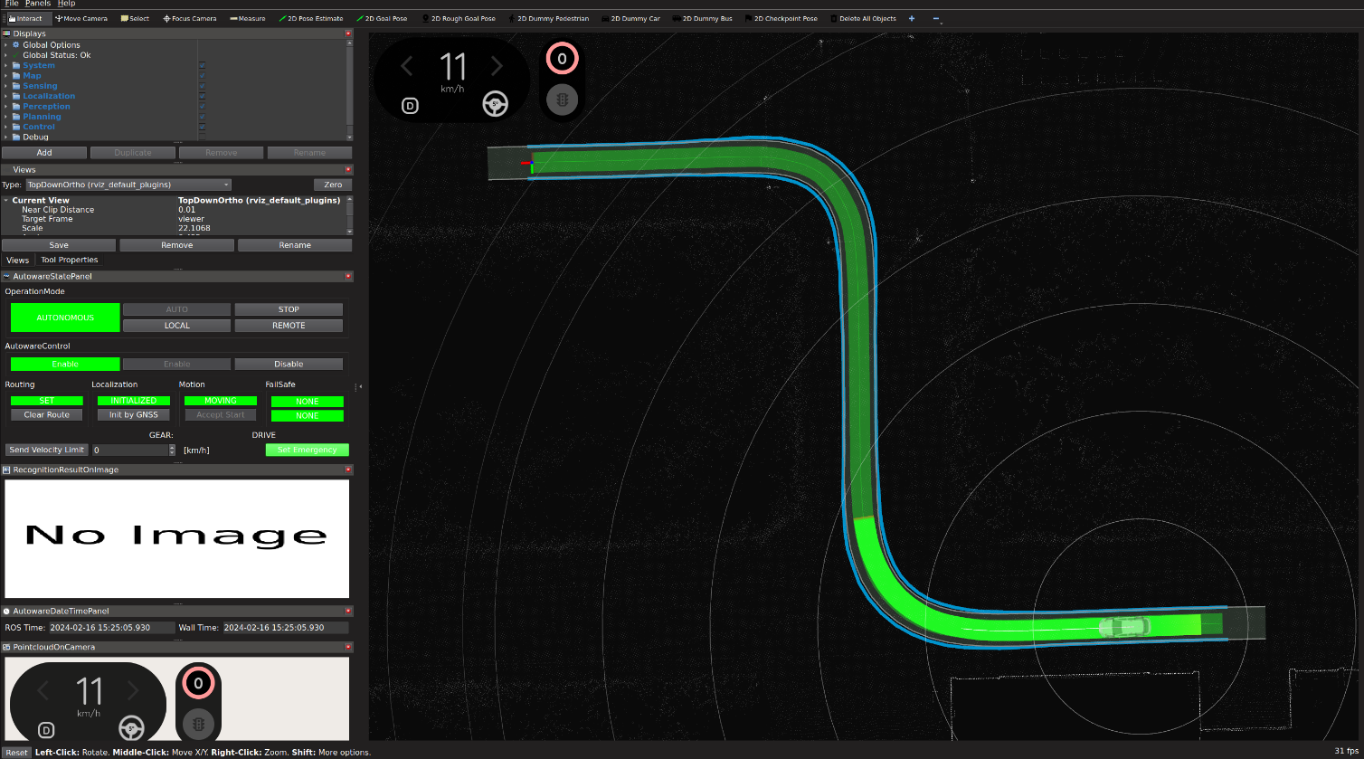
However, it is important to note that this tool has very limited functionalities and can only generate single-lane maps. To enable more comprehensive mapping and navigation capabilities, we recommend using the 'Vector Map Builder' described in the next section.
Tools for a vector map creation#
The recommended way to create an Autoware-compatible vector map is to use Vector Map Builder, a free web-based tool provided by TIER IV, Inc.. Vector Map Builder allows you to create lanes and add additional regulatory elements such as stop signs or traffic lights using a point cloud map as a reference.
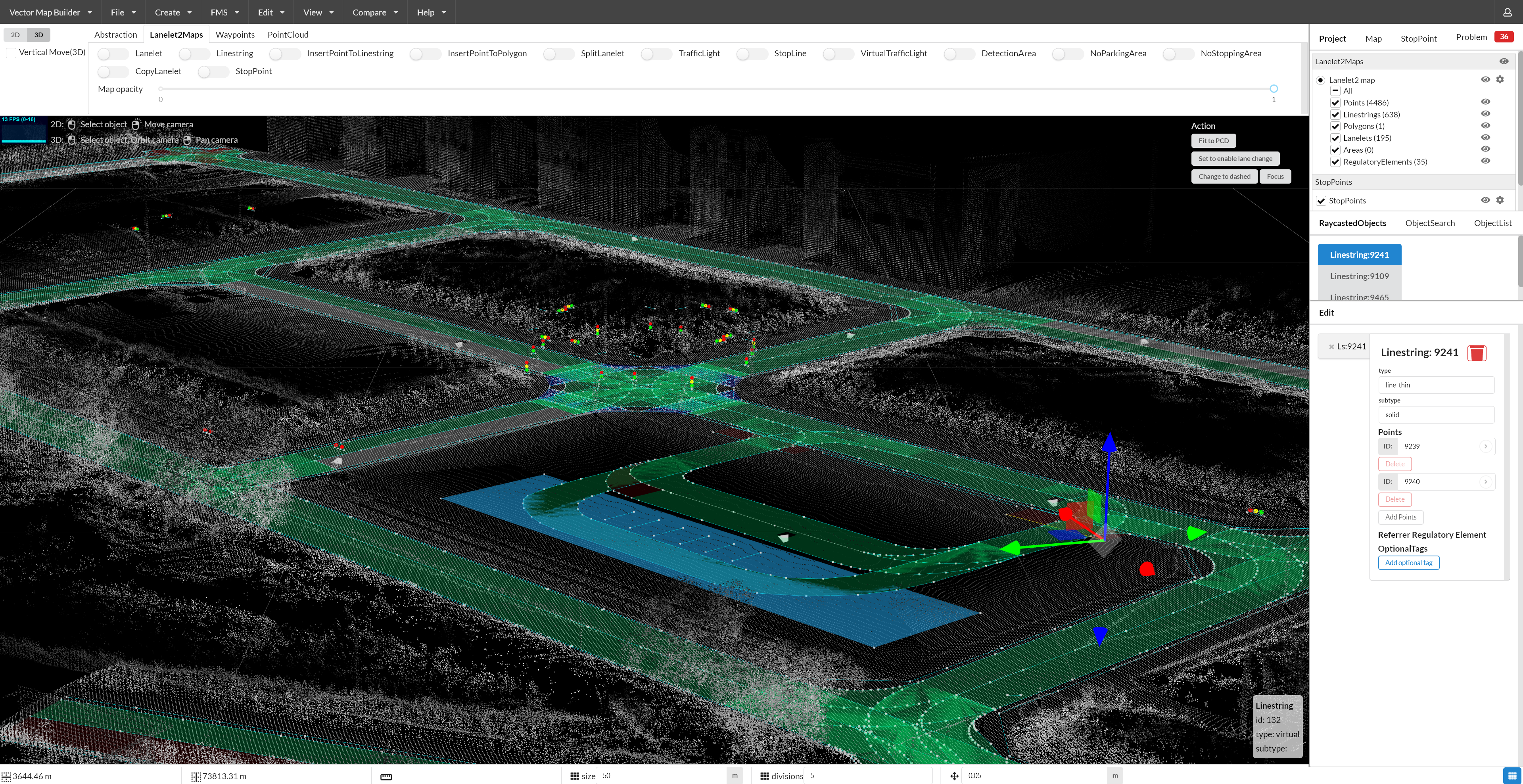
For open-source software options, MapToolbox is a plugin for Unity specifically designed to create Lanelet2 maps for Autoware. Although JOSM is another open-source tool that can be used to create Lanelet2 maps, be aware that a number of modifications must be done manually to make the map compatible with Autoware. This process can be tedious and time-consuming, so the use of JOSM is not recommended.
Autoware-compatible map providers#
If it is not possible to create HD maps yourself, you can use a mapping service from the following Autoware-compatible map providers instead:
The table below shows each company's mapping technology and the types of HD maps they support.
| Company | Mapping technology | Available maps |
|---|---|---|
| MAP IV, Inc. | SLAM | Point cloud and vector maps |
| AISAN TECHNOLOGY CO., LTD. | MMS | Point cloud and vector maps |
| TomTom | MMS | Vector map* |
Note
Maps provided by TomTom use their proprietary AutoStream format, not Lanelet2. The open-source AutoStreamForAutoware tool can be used to convert an AutoStream map to a Lanelet2 map. However, the converter is still in its early stages and has some known limitations.