Stop line#
Behavior velocity planner's stop line module plans velocity to stop right before stop lines and restart driving after stopped. In order to operate that, we will add stop line attribute to our lanelet2 map.
Creating a stop line regulatory element#
In order to create a stop line on your pointcloud map, please follow these steps:
- Please select lanelet which stop line to be added.
- Click
Abstractionbutton on top panel. - Select
Stop Linefrom the panel. - Click on the desired area for inserting stop line.
You can see these steps in the stop line creating demonstration video:
Testing created the stop line element with planning simulator#
After the completing of creating the map, we need to save it. To that please click File --> Export Lanelet2Maps then download.
After the download is finished, we need to put lanelet2 map and pointcloud map on the same location. The directory structure should be like this:
<YOUR-MAP-DIRECTORY>/
 ├─ pointcloud_map.pcd
 ├─ lanelet2_map.osm
 └─ map_projector_info.yaml
The map_projector_info.yaml file tells Autoware the projection of the map. Write the MGRS grid that you entered when you created the Lanelet2 map in Vector Map Builder:
projector_type: MGRS
vertical_datum: WGS84
mgrs_grid: <YOUR-MGRS-GRID> # for example, 35TPF
Use the vertical datum of your point cloud map. For a point cloud map from the UTM to MGRS converter, use EGM2008. If the file does not exist, Autoware reads the MGRS grid from the Lanelet2 map. This fallback is deprecated.
If your .osm or .pcd map file's name is different from these names, add the lanelet2_map_file and pointcloud_map_file arguments to the launch command:
ros2 launch autoware_launch planning_simulator.launch.xml map_path:=<YOUR-MAP-FOLDER-DIR> vehicle_model:=<YOUR-VEHICLE-MODEL> sensor_model:=<YOUR-SENSOR-KIT> lanelet2_map_file:=<YOUR-LANELET-MAP-NAME>.osm pointcloud_map_file:=<YOUR-POINTCLOUD-MAP-NAME>.pcd
Now we are ready to launch the planning simulator:
ros2 launch autoware_launch planning_simulator.launch.xml map_path:=<YOUR-MAP-FOLDER-DIR> vehicle_model:=<YOUR-VEHICLE-MODEL> sensor_model:=<YOUR-SENSOR-KIT>
Example for tutorial_vehicle:
ros2 launch autoware_launch planning_simulator.launch.xml map_path:=$HOME/autoware_data/maps/tutorial_map/ vehicle_model:=tutorial_vehicle sensor_model:=tutorial_vehicle_sensor_kit vehicle_id:=tutorial_vehicle
- Click
2D Pose Estimatebutton on rviz or pressPand give a pose for initialization. - Click
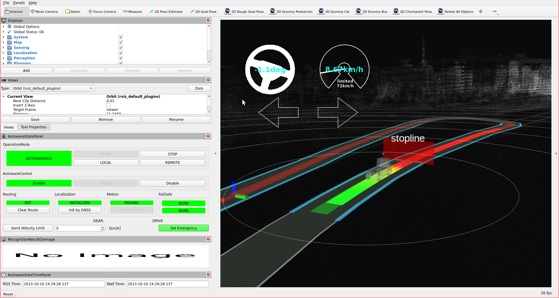
2D Goal Posebutton on rviz or pressGand give a pose for goal point. - You can see the stop line marker on the rviz screen.
Stop line markers on rviz:
You can check your stop line elements in the planning simulator as this demonstration video: